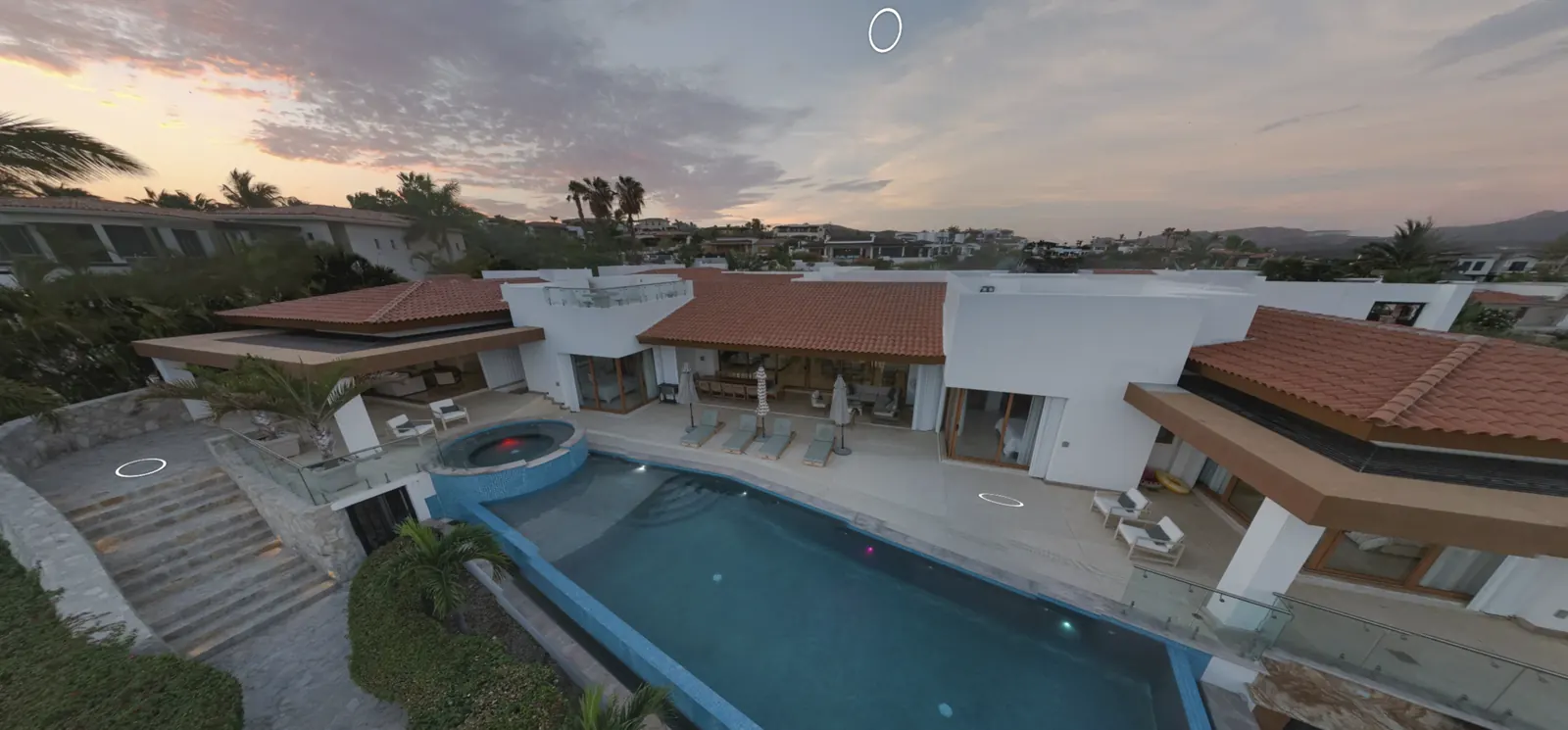
Aerial sunset view of a residence with a pool, captured for a virtual tour

Los Cabos · Baja California Sur

Show, sell and build with every detail in view.

360° tours, photography and RTK drones for hotels, real estate and developments. Your clients explore remotely, and you decide with real data.

Casa Primavera · aerial view from the 3DVista tour 22.89° N · 109.91° W
We work with
  • Matterport
  • 3DVista
  • DJI Terra
  • Pix4D

01 / Tours

Walk through them like your client would.

Two recent projects. Open a tour, move through the spaces and see how your property looks on any screen.

Terrace of room 300 at Hotel El Ganzo overlooking the marina

Drag to look around · tap the circles to move

Hospitality · Matterport

Hotel El Ganzo — Room 300

Puerto Los Cabos, San José del Cabo

A 3D walkthrough of a room with original art and marina views. Guests see the layout and details before they book.

  • 3D walkthrough with dollhouse view and floor plan
  • Info points with embedded video
  • Ready for the hotel website and booking platforms
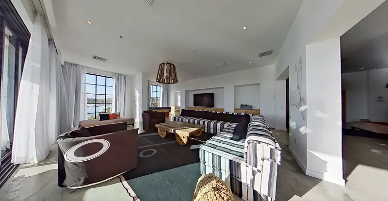
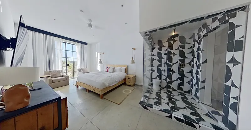
Living area of room 300 at Hotel El Ganzo Bedroom with tiled shower in room 300
Top-down drone view of a residence with a pool next to a golf course

Drag to look around · tap the circles to move

Residential · 3DVista + drone

Casa Primavera

Los Cabos, Baja California Sur

A luxury residence with aerial shots built into the tour. Buyers move from the interiors to the pool and the surroundings in a single link.

  • Aerial drone panoramas inside the tour
  • Interiors, pool and outdoor areas connected
  • One link to share with buyers anywhere
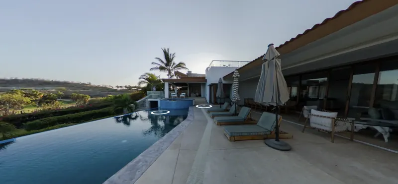
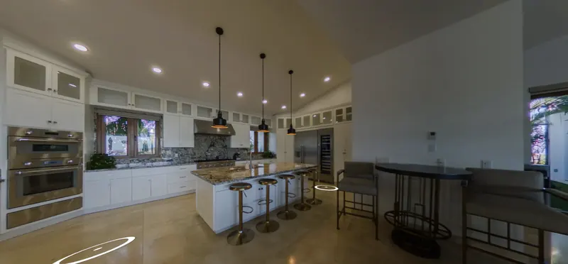
Infinity pool at sunset Open kitchen of the residence

02 / Services

One team, four kinds of projects.

A

Hotels & resorts

Tours of rooms, venues and event spaces. Guests and planners explore before booking, and your sales team shares a link instead of scheduling site visits.

Matterport · 3DVista · photo · video

B

Real estate & vacation rentals

Photography, video and a 360° tour for every property. Buyers and guests anywhere explore it remotely, so the people who show up are better qualified.

360° tour · HDR photos · video · aerials

C

Developments & construction

Recurring 360° walkthroughs and drone flights to document progress. Investors and buyers see real progress, and you keep a dated record of every stage.

Monthly tracking · 360° · drone flight

D

RTK mapping & photogrammetry

Aerial surveys to plan and analyze land: orthophotos, 3D models, point clouds, digital terrain models and contour lines.

Orthophoto · DTM · contours · 3D model

03 / Photogrammetry

From flight to data: your land, measured.

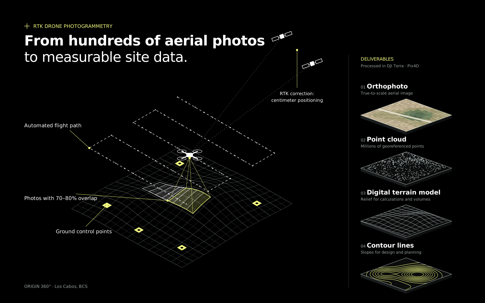
We fly an automated RTK-corrected route, process hundreds of photos and deliver maps and models ready to plan, design or sell.

Drone photogrammetry diagram: flight path, overlapping photos, ground control points and RTK correction, with its deliverables: orthophoto, point cloud, digital terrain model and contour lines.
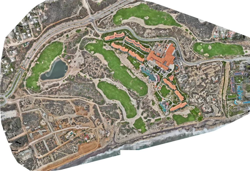
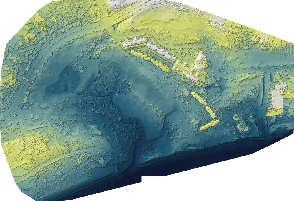
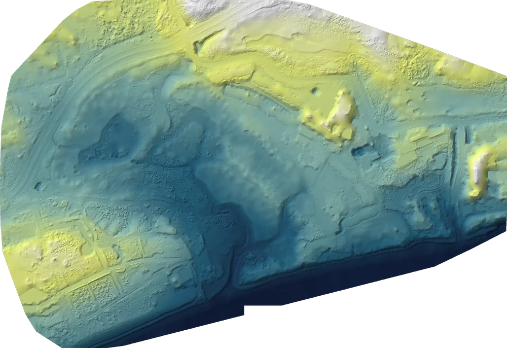
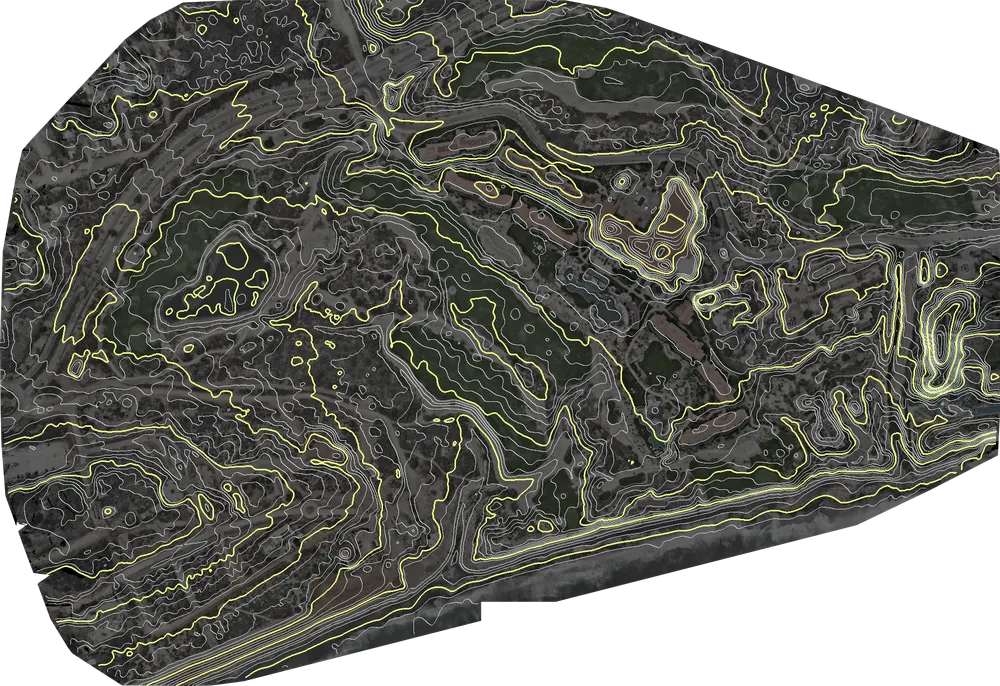
Orthomosaic of a coastal development with a hotel, golf course, roads and the beach Digital surface model of the same development, colored by height, with buildings and vegetation Digital terrain model of the same development Contour lines over the orthomosaic of the same development

Real example · Los Cabos

One site, four deliverables

A single aerial image, corrected and to scale. Measure distances and areas right on it and overlay it on plans and Google Earth.

Orthomosaic resolution: 2.8 cm per pixel.

View 3D model ↓

The same project in 3D, right below. Rotate and zoom in your browser.

Perspective view of the textured 3D model of the coastal development, with hotel and golf course

Drag to orbit · scroll or pinch to zoom

Textured 3D model · same survey

04 / Process

From the first call to the final link.

  1. 01

    Discovery

    We learn about the space, what you'll use it for and who will see it.

  2. 02

    Proposal

    A clear quote with deliverables, dates and investment options.

  3. 03

    Capture

    A coordinated shoot that doesn't disrupt your hotel, property or site.

  4. 04

    Delivery

    An optimized tour, photos, video or maps ready for your website, social media and platforms.

Have a space worth walking through?

Tell us what it is, where it is and its size in m² or hectares. We'll reply with a proposal.

Message us on WhatsApp